Wednesday 27 September 2017

serendipity #7

"Excuse me, are you thinking of camping there?"

That woman in the high-viz tabard has come back.  I knew it'd be a problem.  She has already walked past once.  It's typical.  We're on a little short-cut back road, hardly any houses at all, and we spot a clearing with just a chain across the opening.  It looks like an ideal spot to camp after another hot day.  Gayle and I are wandering back and forth looking for a decent pitch but without any luck.  It's rocky and stony ground.  And now here's this woman again - she must be a council worker in that get up.

"Only, if you want, we have a lovely spot by the river you can camp on.  It's much nicer than here and it's not that far away."


RJ and Jillian
Jillian is on her evening after-work road walk and tells us that she once saw another cycle tourist camped in a lousy spot on this stretch of road, but as he was already set up for the evening she didn't feel like disturbing him.  We, on the other hand, are all too eager to accept her generous offer.  She describes her house and phones the kids so that they are not surprised when we turn up.  It is as she describes - a lovely spot down by the riverside.  When her husband comes home from work he says hello and invites us up to the house for a drink and we spend the evening in their garden by the fire, chatting about all sorts of things.

what a spot

 The day had begun well.  We enjoyed riding the bike trail to Lunenburg, taking us through a series of pretty bays along the way.  The houses looked like those of wealthy owners - unsurprising as there's a fast highway to Halifax from here.  Lunenburg itself is a pleasant little town kept busy with a steady stream of tourists.   We spent a large part of the day looking around, before heading off to camp along the coast.  And that was when we meet Jillian, who saves us from a rocky bed.

Lunenburg

how did we resist the fresh cakes??
In the morning she leaves the house open for us so that we can use the bathroom before moving on.  We are also supplied with fresh eggs from their henhouse.  Jillian has told us about the cafe over the river.  From her side we take a chain ferry (free to cyclists) to the southern side.  And there we find LaHave Bakery - a wonderful place in an old Outfitter's Store.  We feel obliged to stop for a mid-morning tea despite only cycling about 800 metres.  The sun is shining and it's another beautiful day - summer just won't go away in a hurry.

Monday 25 September 2017

rum runners


We are on the edge of the grassy surrounds of Chester station.  The station has no railway - it has long gone - and it stands now in the dusk, a visitor centre closed for business.  It is dimly lit.  We have just finished eating our tea and waiting for the night to come before putting our tent up.  There has been a few dog-walkers but now it's really quiet.  With little talk we start pitching the tent.
"Harruphh!"  We freeze.  "Harrupphh!"  There it is again.  A man coughing.  A man close by.  We are next to a tall hedge and beyond it is the outline of a house.  There's a man stood on the balcony outside the upstairs door having a smoke.  "Haarrupphh!" And a cough.  A real phglemish smoker's cough.  He's about 5 metres away from us but he can't see us and we can't see him.  We daren't move.  And then the door closes.  We quickly finish putting the tent up and shoving all our gear inside.  "Harruphh!" We stop moving.  Just our luck - a chain smoker.


We reached Chester along the Rum Runners Trail - another rail trail that began outside our Airbnb house in Halifax.  As it's a Sunday there are plenty of other folk out on the trail - runners, walkers and cyclists.  It's a very relaxing way to leave a city - no navigation required.  We know the trail goes all the way to Lunenburg.  Along the way we are treated to some lovely rivers, woods and coastline.  Lunch is eaten at a private dock in a cove.  There are some wonderful and large wooden houses dotted around the coast here.  The South Shore of Nova Scotia seems like another world compared to the Eastern Shore.  It helps to have a main highway cutting down just inland from the coast and easily connecting all the small towns and villages with Halifax.


We cycle the next day down to Lunenburg which has a pleasant touristy feel about it.  The town was built by the British to house other protestant European craftsmen and the like to augment the settlement at Halifax.  The story goes that the colonial power devised a town plan without ever setting eyes on the actual geographical location, which might explain the network of streets that are stretched up and across the steep hill above the harbour.  Down on the waterside there are still some large sheds housing boat builders.  But the main business these days is tourism.


The town campground has a great location at the top of the hill but we are not remotely tempted.  A new arrival, a car camper, comes back to the office to complain that the pitch he has been given, in a near empty site, is right next to the only other tent.   There are a few campers on site - the weather is still sunny and warm.  We stock up with water and ride on out of town.


Saturday 23 September 2017

eastern shore

Nova Scotia might be one of Canada's poorest provinces and the Easten Shore is one of the poorest parts of Nova Scotia.  There are no jobs.  David, who's a sailor, has to work from the New Brunswick coast down towards Maine.  As we head down the coast we pass through some dismal-looking villages.  There's not a lot of people living down here. Some houses stand empty and are being subsumed back into the surrounding forest.  There are some notable exceptions - Guysborough has had a philanthropist benefactor invest in the community and - but the overall impression is of abandonment and gloom.  At Sherbrooke the sense of abandonment is enforced by the presence of a complete and preserved village which is now a living museum. It's illuminating.  Mind you, the weather's got a bit crap and there are too many mosquitoes so that doesn't help.

In one village we see a man outside his house and ask if we can get water.  I am beckoned in and enter a small wood-frame house.  The man's wife asks the usual questions and when she sees her husband filling our bag from the tap she remonstrates with him.  Instead she tells him to use the 'spring water' which is stored in 5 litre plastic bottles.  The tap water is not safe for drinking, she says, so they drive up the road to collect drinking water from a spring.


The coast is actually extremely wild and unspoilt.  It's mostly rocky coves and spits of land jutting out into the ocean.  With a cloudy sky it can look bleak and harsh but when the sea mist shifts and the sun is out it's very pretty - the contrast is startling.  The road takes us to the head of the sea lochs that push into the land, and then over a headland to the next bay or inlet, time after time.  

no need for the school bus

To reach Dartmouth and Halifax we find ourselves on a rail-trail that keeps us off busy roads.  We're looking forward to a rest in the two cities that face each other across a bay.  Our final night of camping begins with a warm and clammy camp and swarms, clouds of mosquitoes around the tent.  It then hammers down with rain most of the night and we take refuge for breakfast by some closed-up beach changing rooms.  It's a muddy wet ride into Dartmouth.

the glamour of cycle-touring

We have a couple of places booked through Airbnb, one on each side of the bay.  They are both quite different but comfy and what we need for looking around Halifax and having a break.  Down at the main pier there's a migration museum to mark the important gateway that Halifax was in welcoming immigrants to Canada.  The records show that between 1928 and 1971 they received over a million immigrants here. (We discover a year later that Gayle's uncle and aunty were two of these migrants.) 


While Dartmouth hosts the docks and naval base, Halifax has the snazzy new builds and tarted up old bits.  We're surprised to see the British flag flying over the citadel up on the hill overlooking the port.  A cruise ship disgorges thousands of tourists in one large evacuation of its bowels.  Large people of all ages in bright white trainers are suddenly everywhere.  In the art gallery we marvel at the Maud Lewis exhibition which includes her actual house, painted inside and out, in situ.  The work is marvellous.

a bit different to our Halifax


Maud Lewis' incredible house


Saturday 16 September 2017

serendipidity #6

Somedays you just have to knock at a door to ask for water.  Somedays you just see a tap on a side of a building.  This evening as we start a journey down the Eastern Shore of Nova Scotia we pass a large house where a man is washing a pick-up truck.  I walk up the drive with our water bag and ask if we can get some water.  Come inside, he invites, what part of England are you from? David explains he's worked with Brits on oil rigs, so he immediately picked up the accent.  Where are you camping tonight?, he asks.  Down the road, somewhere.  I know a good place - on a tiny peninsula - just down the road.  David gives us directions to find it and then tells us he'll roll along in his car to check we've found it okay.


It turns out to be a small clearing with a track leading to it - a bit open for us, but David assures us we'll be fine.  He then makes us an offer we can't refuse: would we like to spend a few nights at a cabin by a lake that he and his wife have.  In the morning he returns in his pick-up initially to give us directions and instructions, but then he suggests it'd be easier if he took us there.  So we load the bikes and bags in the back and he takes us down the road.  Do we have food? Good question - we don't.  So David kindly takes us first to the next town, Guysborough, which has a supermarket.  


The cabin is quite a substantial building with a deck out on the water.  The lake is big and there are quite a few buildings dotted around.  Maybe three are permanent homes but the rest are holiday homes and, as David points out, as the summer holidays are over, it's pretty quiet now.  The weather is perfect and the lake is mirror flat.  He shows us what we need to know and heads off with instructions for when we leave. Wow. Such kindness and hospitality.  


We spend three days here relaxing, reading, doing little jobs we never get round to normally, sunbathing, swimming.  Is it really September?  On the second day David brings his wife Nancy over to meet us.  She's brought fish and cooks it for our dinner.  We spend a lovely day chatting and relaxing with them.  After we have said our goodbyes and they've driven off we realise we only know their first names.  David and Nancy.  We even have no photo of them. How to thank them for all this?

Monday 11 September 2017

trailing

lunch stop
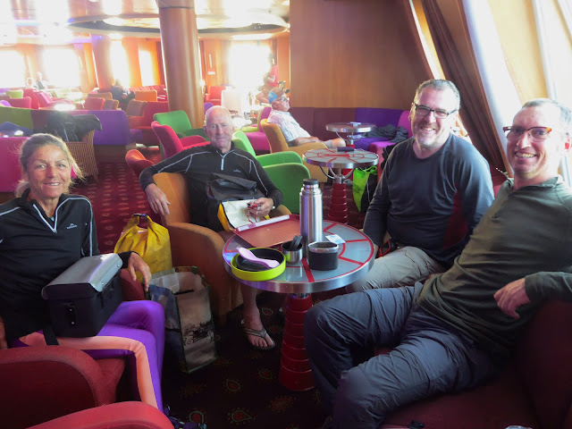
Well, the less said about the ferry the better.  At one point the captain announced they were changing direction and that passengers may prefer not to walk around the ship.  But by this point anyone with any sense was lying down with their eyes closed.  Mark, the benevolent Irishman, had a cabin with three spare bunks.  It looked kind of claustrophobic to me so I lay down on the floor in a lounge whilst the others squeezed in. There's nothing quite like the sight of dry land after a ropey night on a boat.  North Sydney looked positively welcoming.
clearly there are no hungry bears in these parts


Looks can be deceiving.  We have to wait for the Tourist Office to open - ostensibly to get information, but also to get water and use the facilities.  Garry and Corinna wait with us and we take it in turns to get changed around the back of the building.  (This isn't odd behaviour is it?   Writing this a year later in England I wonder at how easily we can recalibrate our 'normality' gauge.)  The Kiwis are planning to head around the Cape Breton coastline but we think we'll just pootle on southwards directly towards Halifax, so we split up.  However, after restocking at the shops, we start considering the Cabot Trail around the cape.  It sounds tempting. Okay, we'll give it a go.
chain-ferry

 
a nice spot to watch a full moon rise
The trail begins with a chain-ferry across a very short gap taking us onto a long causeway and saving us from cycling around a long sea loch.  We camp at the base of the causeway in a tiny nook between pebble beach and road and then the next day follow the coastal road through a scattering of arts and craft shops before climbing a steep vertiginous section onto some clifftops.  A long descent through woods and around a couple of pretty bays brings us to the visitor centre for the National Park at Ingonish Beach.  Tourists are coming in to book camping spaces and we are doing our laundry.  Then we see that the forecast is for a storm to pass through the next day so we slope off to find a place to camp where we can sit out the bad weather.  There's nothing quite like a tent day to catch up on your reading, sudokus and crosswords.


helpful road sign
After the storm comes sunshine, rocky rugged coastlines and gentle roads until we round the top of the Cape and head north westwards.  We notice the signs and place names in Gaelic and enjoy the stunning views along the coast.  So this is what all the fuss is about, eh?  


There are lots of folk driving the trail and quite a few Harley Davidsons - reminding us of the roads in Quebec.  In one village we pass through there are showers at a tiny sports centre for tourists to use.  So we use them.  There are plenty of picnic spots and parks too.  In the late afternoon we stop at a shop for food.  There's nothing useful but there is a freezer full of ice cream.  We've been feeling the sun so we indulge in a litre tub and take it out to the deck in front of the shop, dig out our spoons, and eat the whole lot straight from the tub.  

sunny breakfast spot before the climb
Our road has turned south westwards and begins ascending to a pass the next morning.  It's a toughie.  Granny gear.  A bit of pushing.  Then back to the granny gear.  Finally the top.  Then a huge descent.  A scary fast descent down long straight stretches.  Some twists and turns and we are spat out at the sea.


And then straight back up again, climbing up to a viewpoint and then pressing onwards to another long flat pass.  The road has turned to mush - the tarmac has been stripped back and now it's raining.  We continue back out along the coast, the road keeping high up above the sea.


It's a dramatic ride in the rain and we're happy when it stops and we can start to dry out.  We end the day getting cleaned up at another visitor centre before heading on to Cheticamp.  Unable to find a wild camp spot we finally settle for a gap in trees about three feet from the road.  In the dark no-one can see us.  In the morning we give a dog-walker the fright of his life.

we learn later that Cheticamp means 'not a good place to camp'

  Cheticamp is a francophone settlement with cheerful women in the visitor centre.  We spend a bit of time with them and learn that the French who settled here mainly came from Louisiana - that was the place where many French went after the British insisted on a loyalty pledge to the king (this was before the American War of Independence).  Many French refused and were deported but some returned later.  It's here we meet three Englishmen who've cycled across Canada - going in the opposite direction - we stop, chat, exchange stories, say goodbye.  Oh well.


When we reach Inverness along a small coastal road (labelled the Ceilidh Trail for tourism purposes) we are interested to discover a rail-trail that would take us all the way to the causeway at the bottom of Cape Breton Island.  A local spots us with our loaded bikes and tells us where we can get onto it.  The advantages of the rail-trail are principally that there's no other traffic and the route is generally flat and wild camping spots are easier to find.  What's not to like?  If you get bored you can always listen to music.  And so we take it.


The trail leads through a lot of forest and across boggy swamps, across bridges and through cuttings, and occasionally a village.  At dusk we are heading down a very long straight stretch through woods when in the distance we see two large dogs cross the track.  Thinking about it later, these weren't anyone's pets.  But they looked too large to be coyotes.  Were these the coydogs we'd read about??  Gayle laughs off my hypothesis.  That night, with a storm threatening, we seek refuge from a strong wind behind a liquor store in a village.  The store is closed but the security light above our tent stays on all night long - like a full moon that doesn't move.

As with all rail-trails, after a day we are thoroughly bored and want to get back to a road with hills and views.  But the ride to Port Hastings finally pops us out on the coast for the final stretch.  Once again we can see the sky, feel the wind, and get a sense of where we are heading after the sensory-deprivation of riding too long in a tunnel of trees.  Port Hastings is the gateway to Cape Breton Island and is thus blessed with a visitor centre.  It's an obligatory stop.

Wednesday 6 September 2017

the end of the line


"Guten Tag!!" The woman in the shop is beaming at us.  We instinctively look over our shoulders.  No-one else is there. We're English, Gayle protests.  Are we from the cruise ship? No, not at all!  Walking into the town centre this morning it looked as if they'd just built a brand new hotel on the harbour front. A big ugly one.  That blocked out the view of the wonderful harbour.  But no, just another cruise ship.  


We meet up with Laura and Mike, just come into town, and have lunch with them and meet their "awesome" and charming daughter at the Italian restaurant where she works.  We then head out to the point beyond the cliffs - the most easterly point of Canada.  It's where Mr. Marconi, using a kite to keep his aerial aloft, received the first transatlantic radio transmission from Britain. Pfff! A kite? And where's Mr. Marconi now?? You might well ask.
 
with Mike - good kite-flying weather

If you're cycling the Trans-Canada from the west coast then this is really where you should be ending your ride - never mind taking the short route to Halifax. What seems odd to us is that St. John's is further south longitudinally to Britain than we imagined.  Outside a supermarket we do meet two women who are on bikes.  One is heading westwards having just flown in and another has just arrived after crossing the continent in a ridiculously short time - two months???!! Holy Hannah.


To get over to Nova Scotia we retrace our steps to Whitbourne and then out on a little road towards the port of Argentia.  Along the way we want to stop to camp by the road and are waiting for the road to be clear when a car pulls up about 200 metres away.  Weird.  We just stand there.  Eventually a woman gets out and walks towards us.  "Is this the right direction to get to St.John's?"  Er....no....you need to go in the opposite direction.  "Thanks"  And off she goes.


When we reach the port, an old naval base, the ferry is already there.  There's also two more cyclists, Garry and Corinna from New Zealand.  They've completed their Trans-Canada ride but have some time before their flight home from Halifax.  They are tired - it's a long journey.  We were looking forward to the ferry ride but the wind is really strong and it's a long crossing.   In fact almost as soon as we leave the port the ship is rocking and rolling.  Heave ho!!
 
still in dock with Corinna, Garry and Mark, a benevolent Irishman

Translate